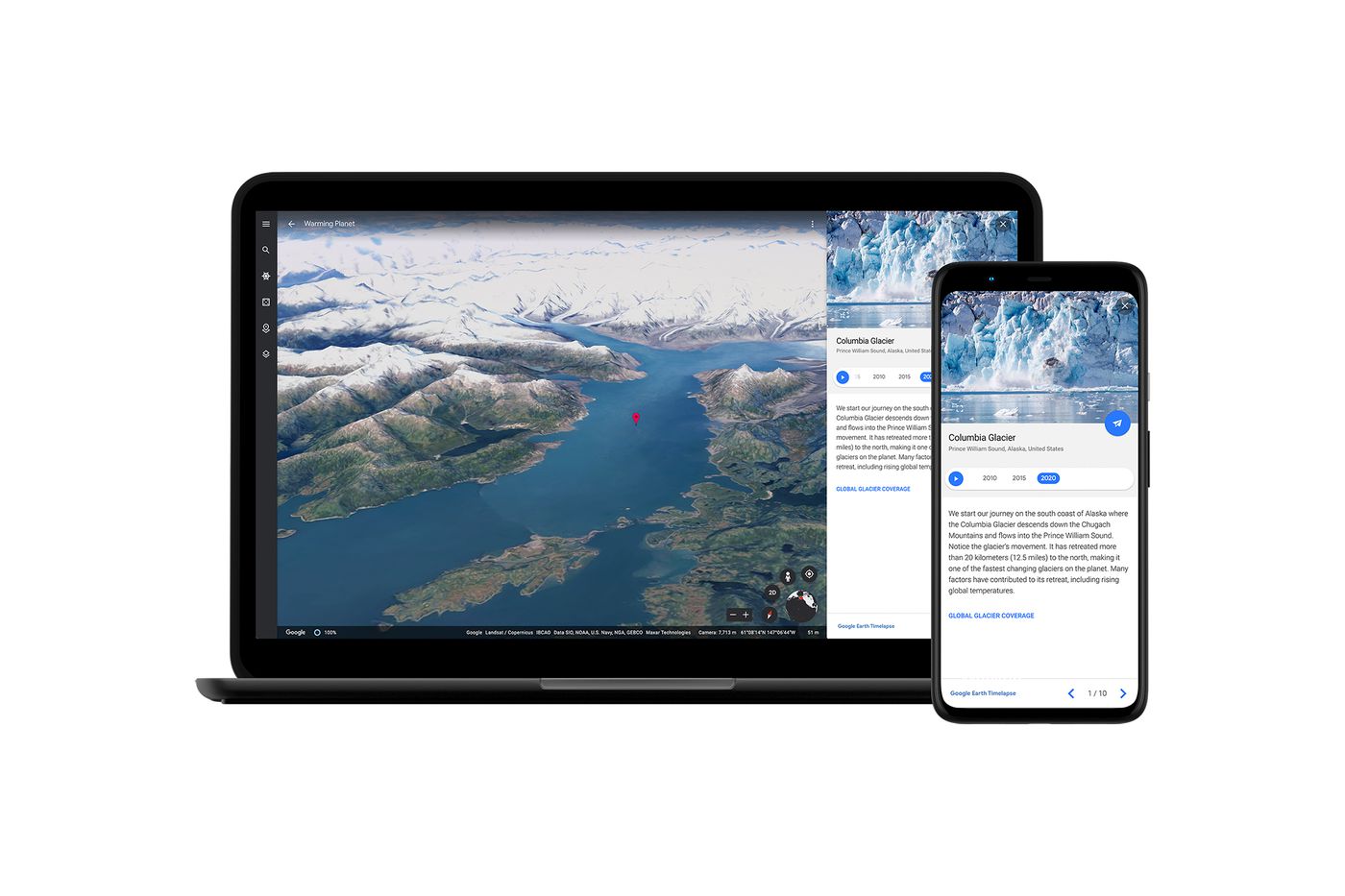
Google Earth Timelapse maps how our planet has changed since 1984
The 3D timelapse in Google Earth shows deforestation, global warming, mining and natural phenomena in a new light


Get all the latest news, reviews, deals and buying guides on gorgeous tech, home and active products from the T3 experts
You are now subscribed
Your newsletter sign-up was successful
The power of Google Earth is once again on display as a new feature highlights the drastic changes to our planet in the last 37 years. A series of timelapse videos available in Google Earth focuses on areas of extreme change from 1985 through to today, including changes to forests, glaciers, rivers, cities and more.
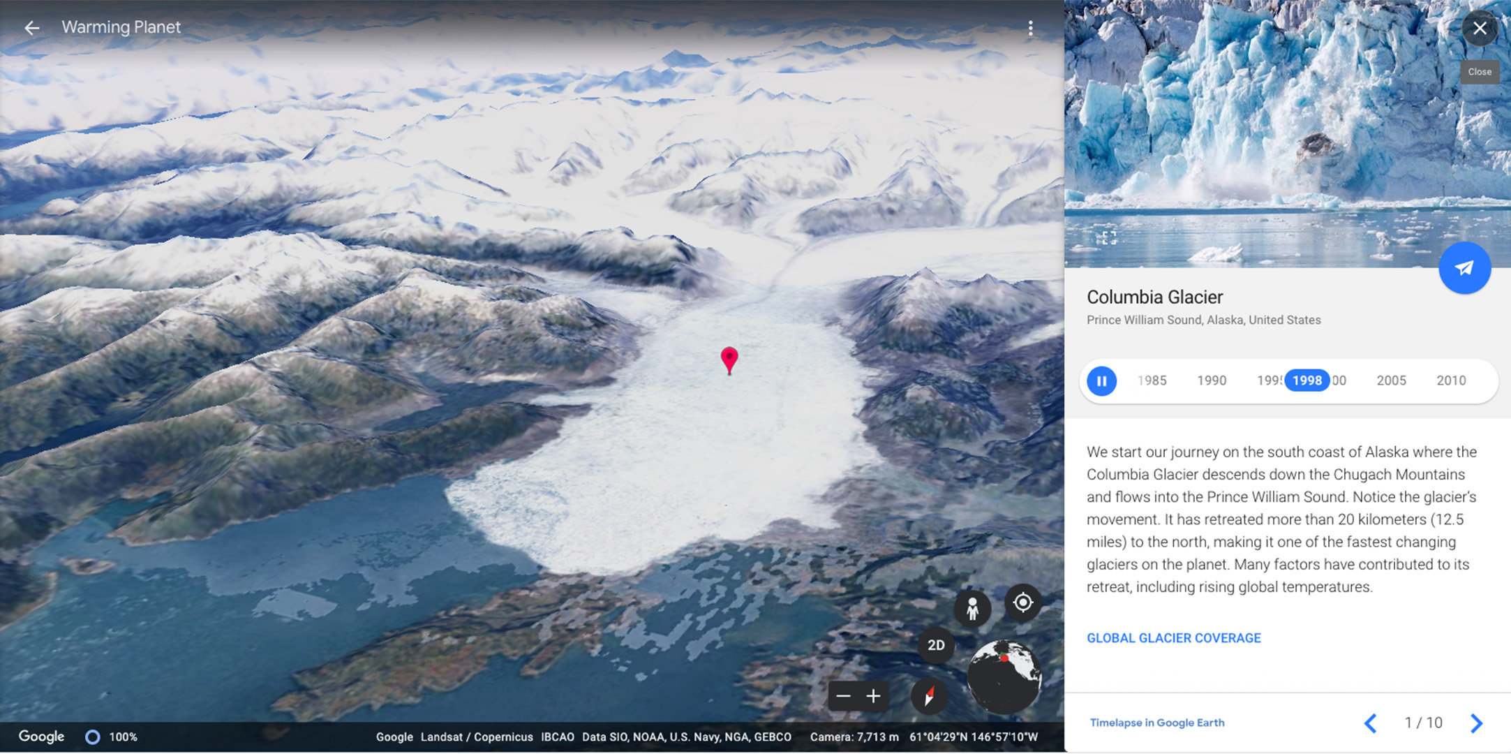
The feature offers a series of stories and featured locations that show some of the most interesting locations, including the forests of Brazil, the glaciers of Alaska and the expansions of megacities such as Beijing and Dubai. You can also start typing in the search to discover other locations. Hong Kong airport being built in the sea, for instance, is really impressive.
Available on both the app and web versions of Google Earth, the timelapse uses over 15 million satellite images taken over the past four decades, collected by five different satellites. One thing that does become obvious, when you zoom right in, is that early satellite images were much less clear than those of today, so as well as the timelapse showing the changing landscape, it also gets better quality as it moves to modern-day.
- DJI Air 2S camera drone leaves Mavic Air 2 in the dust with one-inch sensor
- Google Maps just got a much-requested upgrade drivers will love
- Canon EOS R3: the mirrorless R-series camera goes pro

The Columbia glacier timelapse on Google Earth
But, as Rebecca Moore, director of Google Earth said in a press call, “it’s not about zooming in, it’s about zooming out.” This timelapse allows you to take a step back and see the large picture of how much things have changed across the globe.
Google Earth first offered timelapse views back in 2013, showing changes from 1984 to 2012 and provided an update in 2016. However, these were all in 2D. The new timelapse videos all show in full 3D, allowing you to pan and tilt around the scene as you desire.
As the big brother to Google Maps, Google Earth has always been a hugely powerful tool that helps to educate, inform and amaze. We could get lost for hours exploring new places on Google Earth and rediscovering old haunts. At a time when international travel is virtually impossible, it’s the closest we can get.
While some of the urban changes are impressive, others are more frightening and show just how much damage has been done to our natural world. Each of the stories comes with a description that explains and educates on the causes of the changes. We highly recommend spending some time reading and exploring.
Get all the latest news, reviews, deals and buying guides on gorgeous tech, home and active products from the T3 experts
To view timelapse in Google Earth, open Google Earth in your browser, click on the Voyage icon (ship’s wheel), then click layers > Timelapse in Google Earth. You can also download the Google Earth app for Android or iOS.

As T3's Editor-in-Chief, Mat Gallagher has his finger on the pulse for the latest advances in technology. He has written about technology since 2003 and after stints in Beijing, Hong Kong and Chicago is now based in the UK. He’s a true lover of gadgets, but especially anything that involves cameras, Apple, electric cars, musical instruments or travel.