
-
 3 things I love about the new Apple CarPlay Ultra – and one I don’t
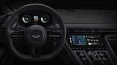
I tried out the latest version of Apple CarPlay Ultra in the Aston Martin DB12 S
-
 Govee launches smart lighting system designed specifically for car interiors
It's also a lot more affordable than you'd think
-
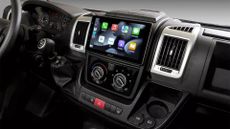
 CarPlay just got a new app integration which Android Auto misses out on
Android users are missing out on a popular app
-
 Google Maps just upgraded Android Auto for millions of EV drivers
Google Maps brings EV trip planning to hundreds of new electric models
-
Android Auto now lets you use YouTube in the car – but there's a catch
This might change long drives for many of us
-
 Give your car the ultimate audio upgrade with the new Focal Slatefiber speakers
These make use of a neat new technology in their construction
-
 I tried a Waymo ride ahead of its London debut – Uber’s days could be numbered
Driverless taxis are coming to the UK with Waymo expected to be the first this year – here’s what it’s like to ride in one
-
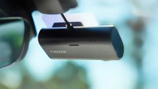
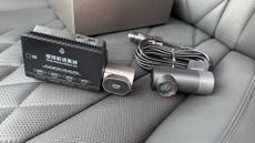 70mai 4K T800 Dash Cam review: superior shooting from three angles
A beefy three camera setup offers excellent quality video coverage for inside and out of any vehicle
-
 This simple CarPlay update fixes an age-old AirPods problem
It should stop a lot of annoyance for Apple fans
-
 Where we're going, we don't need roads – Xpeng sees a future in AI robots and flying cars
Alongside the first showing of its new EV, Xpeng demonstrated its additional talents
-
 Want your drive to sound like a Beatles live recording?
The Abbey Road app is rolling out in Volvo and Polestar models right now
-
 This working Star Wars speeder bike seems too good to be true
Volonaut could bring your Return of the Jedi fantasies to life
-
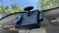
 Nexar Beam2 Mini Dash Cam review: solid performance for always on use
The always-on appeal of the Nexar Beam2 Mini Dash Cam is a big draw, but this affordable model also delivers some irritations
-
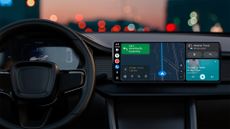
 Gemini is coming to Android Auto – and I can't wait
The announcement came at The Android Show
-
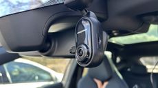
 Garmin Dash Cam Live review: easy to use and great results but for a price
This constantly connected LTE dash cam is handy if you’re after continuous live monitoring even when you’re not behind the wheel.
-
 Best dash cam 2026: top car cameras tested, reviewed and ranked
We tested dozens of dash cams from Garmin, Nextbase, Thinkware, Cobra, and these are the best on the lot
-
 Nextbase Piqo Dash Cam review: compact but clever
The Nextbase Piqo is a condensed edition of the brand’s premium iQ model with many of the same features
-
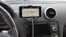 Best car phone holders 2025: mount your smartphone securely in your vehicle
Buying Guide The best car phone holders to mount your smartphone in your car for easy access to GPS and hands-free calling
Buying Guide -
 Best car accessories 2025: auto tech you never knew you needed
From dash cams to key locators, we’ve put together a list of the best car accessories for your wheels
-
 Best Apple CarPlay stereo 2025: refresh your old car with the top connected head units
Apple CarPlay isn’t just for those who can afford the latest premium SUV, as nearly all motors can be brought bang up to date with a new head unit
-
 Best sat nav 2025 for your car, motorbike or bike
Buying Guide Seeking the best sat nav? With models from TomTom, Garmin and more, you have arrived at your destination...
Buying Guide -
 Want an LG TV in your car? You might already have one
LG TV WebOS is already powering some of the best in-car streaming systems on the market, and it offers more than your phone can
-
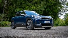 Mini Aceman first drive: a funky and affordable compact electric crossover
Outgrown your Cooper? Mini has the mid-size EV for you
-
 This battery recycling masterplan could make EVs live forever
Mercedes-Benz hopes to recycle up to 96% of its EV battery pack in cars like the Concept CLA Class
-
 Android Auto finally gets Google Maps feature that's been on CarPlay for months
Parity is resumed
-
 Android Auto gets a small but brilliant update that improves navigation
Driving with Android Auto just got a little easier
-
 Hyundai Ioniq 5 N review: an astonishing drive through the uncanny valley
If this is the future of EV sports cars, then sign me up
-
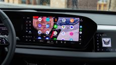
 Users of popular Volkswagen cars set for massive gaming upgrade next month
Is this the ultimate portable gaming solution?
-
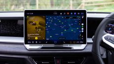
Google Maps on Android Auto set to get a boost – but for now, there's a catch
There are some really neat features on offer


