Komoot users just got a cool new update
AI-powered, image recognition technology brings Komoot maps to life with user-sourced photos of trails


Komoot is awesome. If you're a cyclist and have a Garmin watch or cycling computer, it's likely you've already come across the app; but if you haven't, I recommend giving it a try, especially now that Komoot launched Trail View – a 'unique proprietary technology that brings maps to life'.
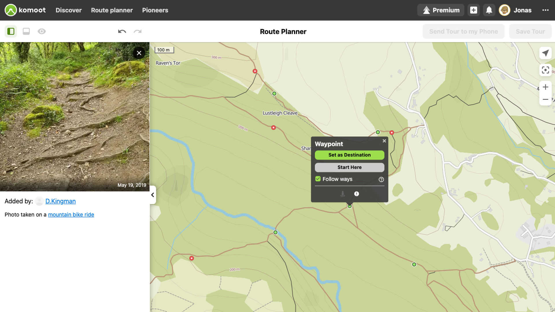
How, you might ask? Komoot scanned over 15 million images from its 28 million users and used an image recognition machine learning algorithm to curate these images. Showing up as green dots on the Trail View map layer in Komoot, when clicked, the images contributed by other Komoot users who have been on that trail already are presented to other users. Here it is in action:
If you're concerned that you'll be presented with a bunch of underexposed, crappy images, rest assured that not all user images will pass the Trail View test. Trail View scans all uploaded pictures and shows only those with paths and trails; it eliminates images that do not fit the criteria (i.e. images that include faces, animals, landscapes, buildings etc.).
What's in for you, dear Komoot user? According to Komoot, Trail View 'adds an additional dimension to route planning, enabling users to verify what the trail looks like so they can make informed decisions about whether a specific trail is suitable for their sport or level of experience'. In short, it makes planning unknown routes easier and, most importantly, safer.
Using Trail View, clear information about the condition and composition of the trail can help mountain bikers choose the right equipment, hiking families and groups to reduce risk, and gravel cyclists to avoid paths with rocks – 'increasing the likelihood of Type 1 fun all-round', Komoot adds.
For more info, visit Komoot today!
Get all the latest news, reviews, deals and buying guides on gorgeous tech, home and active products from the T3 experts

Matt Kollat is a journalist and content creator for T3.com and T3 Magazine, where he works as Active Editor. His areas of expertise include wearables, drones, action cameras, fitness equipment, nutrition and outdoor gear. He joined T3 in 2019.
His work has also appeared on TechRadar and Fit&Well, and he has collaborated with creators such as Garage Gym Reviews. Matt has served as a judge for multiple industry awards, including the ESSNAwards. When he isn’t running, cycling or testing new kit, he’s usually roaming the countryside with a camera or experimenting with new audio and video gear.