Experts urge caution after hiking app route suggestion results in mountain rescue mission
Three walkers and a dog get stuck on steep ridge in Cumbria after taking an off-piste route suggested by popular hiking app AllTrails
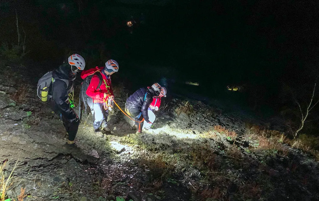
Three walkers and a dog had to be rescued after becoming stranded on a fellside in the Lake District this week, after following a route recommended made by the international hiking app AllTrails that led them to attempt a dangerous descent.
The trio of women and their dog had been walking a circular route to Lord's Seat when they became stuck on the precipitous flanks of Barf Fell near Bassenthwaite Lake, having opted to take a return route suggested by the popular app AllTrails, which sent them down a steep scree slope with no path. In rapidly diminishing light they very sensibly called for help by dialling 999, and were rescued by the Keswick Mountain Rescue Team.
Just a few days into the new year it was the team’s fourth call-out in 2023. "There is no path via this route - only a scramble of loose scree which also requires the walker to negotiate the rocky outcrop of Slape Crag,” the team leader told the BBC. "It's the scene of previous call-outs.”

One of the circular routes to Lords Seat suggested on AllTrails (the route the women were following has now been amended)
AllTrails, a hiking app based in the United States, say they have made changes to their route recommendations in the area, and have sought advice from the Mountain Rescue Team to make their suggestions safer. A spokeswomen told the BBC that the company had reviewed the trail and updated the map, and insisted that: "Trail safety is of the utmost importance to AllTrails and we work directly with parks and land managers to ensure the public receives the best possible information.”
However, the incident underlines how important it is for walkers to plan ahead and use proper navigation techniques and equipment, and not rely entirely on information supplied by individual apps. This is especially important in the extra challenging conditions of winter, and in technical terrain and highland environments, where getting lost or making a mistake can have serious, or even fatal consequences.

Walkers in Britain enjoy arguably the best mapping available to civilians in the world, with Ordnance Survey cartography covering the entire country in incredible detail. Carrying a sheet map for the area you are exploring is always recommended, along with a good compass, but there are also myriad digital devices and apps available that utalise OS maps, which can show you exactly where you are, as well as providing valuable details about the terrain around you, including the route of footpaths and bridleways, and contour lines that will reveal how steep the terrain is.
The OS mapping app can be used on all good smartphones, and this will give you the most up-to-date cartography, as well as revealing your current location. A good handheld GPS unit, kept updated, will also display this important information on a relatively large screen, and the best best outdoor watches and smartwatches also boast GPS capabilities and mapping functions these days.
At any time, but particularly in the most challenging situations, it’s best to use a sheet map in conjunction with a digital device to double check you’re heading in the direction you want to be walking in, or that you’re on the path you think you’re on.

There are some really good hiking apps out there, but many are designed and updated by people based far from the location you’re exploring who don’t have an intimate knowledge of the local terrain, and they can feature unchecked and unmoderated information and routes uploaded by users who might be more confident (or blasé) about venturing off-piste than you are - or who might have done the walk described in perfect summer conditions, as opposed to in the wet, dark midst of winter.
When walking in winter conditions, especially in technical terrain or remote locations, it’s also well worth carrying a device such as the Garmin inReach Mini, which easily fits in the pocket of your walking trousers or backpack, and not only offers extra navigation capability, but can also be used to call for emergency assistance when it’s really needed, even when your phone doesn’t work.
Lastly, be sure to support the mountain rescue teams in the wild areas you visit – they're all volunteers, rely entirely on donations, and one day they might save your life, or the life of a loved one.
