Garmin inReach Mini 2 hiking GPS review: stay connected when off-grid
The Garmin inReach Mini 2 uses satellites to keep you in touch and out of trouble

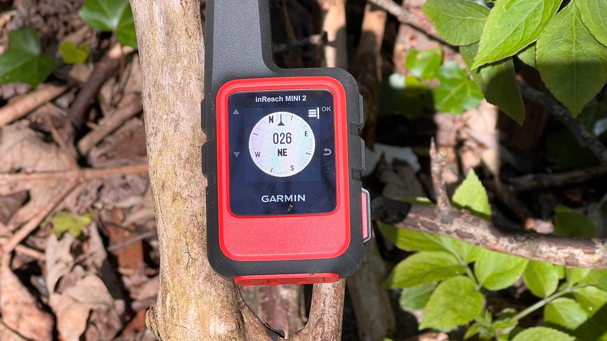
For the Garmin inReach Mini 2, Garmin has taken the already impressive inReach Mini and made it faster, more accurate and more useful. There's a new digital compass, multiple satellite service support and faster location fixes, and while the communications features are best suited to simple progress updates or emergencies they work well. It's a tough device for tough treks.
-
+
Very portable
-
+
Very capable
-
+
Very tough
-
-
Some features cost extra
-
-
Texting is fiddly
-
-
Small size means smaller battery
Why you can trust T3

In this Garmin inReach Mini 2 review we're looking at the latest version of the firms' portable GPS and satellite communicator. It can go where your phone can't, using multiple GPS services together with the Iridium satellite network to provide location tracking, weather reports and messaging no matter where in the world you are, and it has an SOS feature that will automatically connect to Garmin's 24/7 emergency response coordination centre.
On specs alone, this should be one of the best hiking GPS units around, which is not surprising given that this brand is a market-leader when it comes to GPS products (it's one of two big brands that dominate our best sat nav guide, and today's best Garmin watches are common runner favourites). The Mini 2 is extremely small and extremely tough, and it delivers up to 30 days of battery life (14 days in the default tracking mode) so you can rely on it for even the toughest trek. Its battery can remain fully charged for up to a year, and if you opt for a Freedom subscription plan you can pause your subscription during periods when you don't need it. So how did it hold up in our tests? Read on for our full Garmin inReach Mini 2 review.
Garmin inReach Mini 2 review: price and release date
The Garmin inReach Mini 2 launched in February 2022, and at full price will set you back US$399.99 / £349.99 / AU$579.
Satellite communications aren't cheap but there's a good range of plans here, starting at $11.95 / £14.99 / AU$25 for consumers. Garmin's Freedom Plans don't tie you to an ongoing contract and you can suspend service without closing your account, which is useful if you only need the features at certain times of the year.
Garmin inReach Mini 2 review: features and what's new
There are two sets of features: the core navigation and location features of the inReach device itself, and there are the additional communication features that you get with an inReach subscription. Let's start with the core ones first.
Every user gets the ability to store up to 500 waypoints, favourites or locations and up to 20 navigation routes, and it's easy to set and sync points and routes on the accompanying iOS and Android app, which enables you to download maps and points of interest as well as get waypoints shared by other users with you. There's GPS and GPS Compass while moving, and the device pairs with all kinds of Garmin devices including marine and aviation devices as well as the obligatory smartwatches and trackers.
The navigation works very much like it does in Garmin's eTrex portable GPS devices, albeit on a smaller canvas, and the trackback system is very useful by saving breadcrumbs at specified intervals so you can retrace your steps.
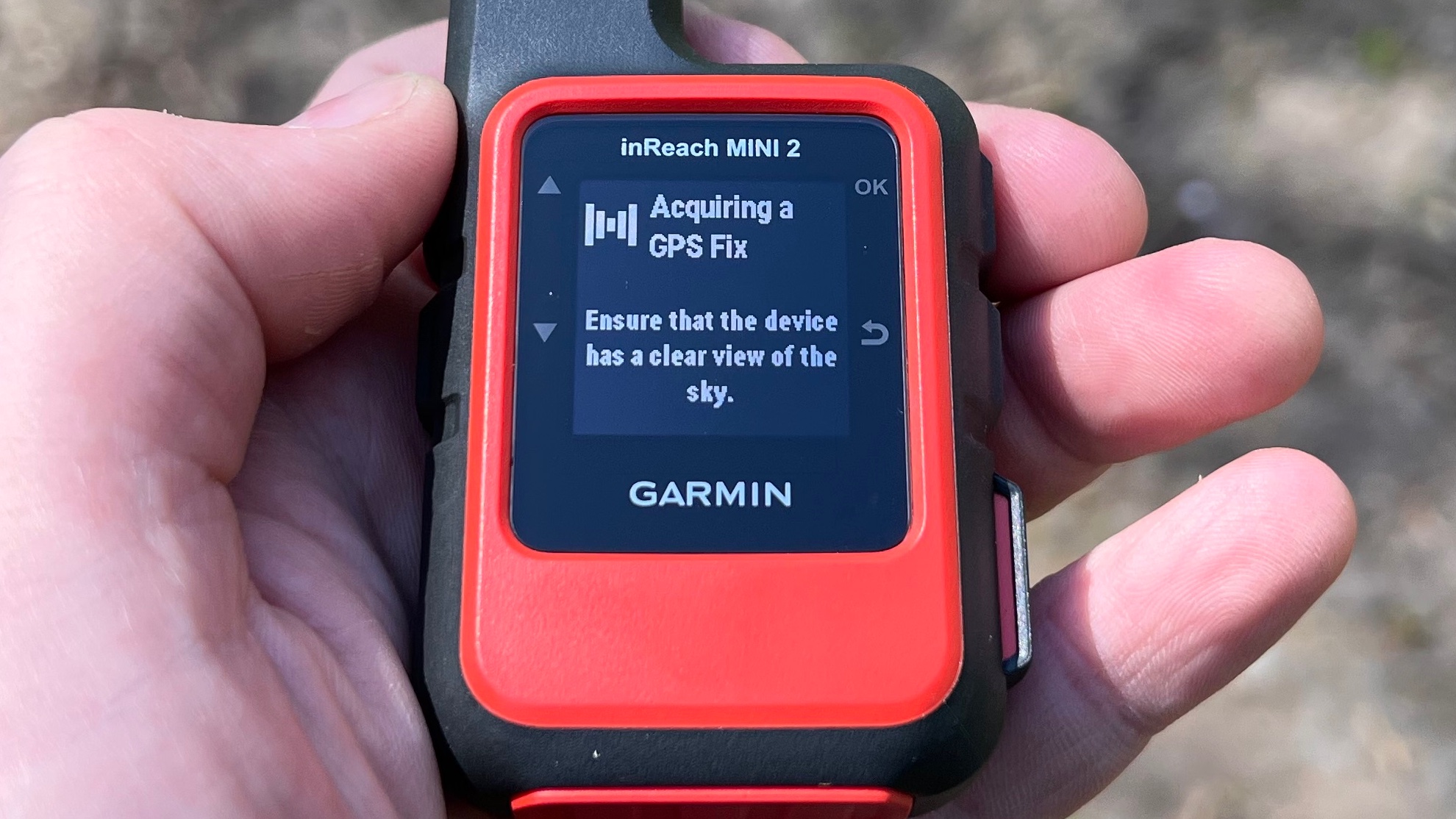
The inReach Mini 2 needs to have an unobstructed view of the sky so it can see the satellites
If you're not familiar with satellite devices, it's important to understand that they don't work like the GPS or communications apps in your phone do. They need to be able to see the satellites they're connecting to or getting their location data from, and that requires a clear line of sight: even something like tree cover, tall buildings or steep-sided gorges can get in the way, and it can sometimes take a while for your device to get a fix. Phones get around this by using A-GPS, which uses mobile phone network data to help locate you, to guess roughly where you are and to get you moving before you've locked on to any satellites. The Garmin doesn't do that because it's designed to be used in places where there isn't a mobile phone network.
It's important to note that in some countries there are severe penalties for even owning a satellite communicator or having one without a permit. Garmin very helpfully provides an up-to-date list of those countries on its website.
Garmin inReach Mini 2 review: design and display
The Garmin inReach Mini 2 comes in two colours, the Flame Red in our images and a more sober black. We prefer the red, as it's easier to see when it's sat among a pile of stuff. It comes with a very rugged shell that's more than tough enough to survive drops, and there's a strong loop on the back for attaching the included karabiner clip. The device is rated to IPX7 for water resistance and it has an impact test rating of MIL-STD-810. It looks bigger in photos than it is in real life: including the built-in antenna it's just 5.17cm tall and it weighs a pack-friendly 100g.
The design is deliberately simple, with just six glove-friendly buttons including that covered SOS one. On the left are the up and down navigation buttons; the power button is on top and the OK, Back and SOS buttons are on the right.
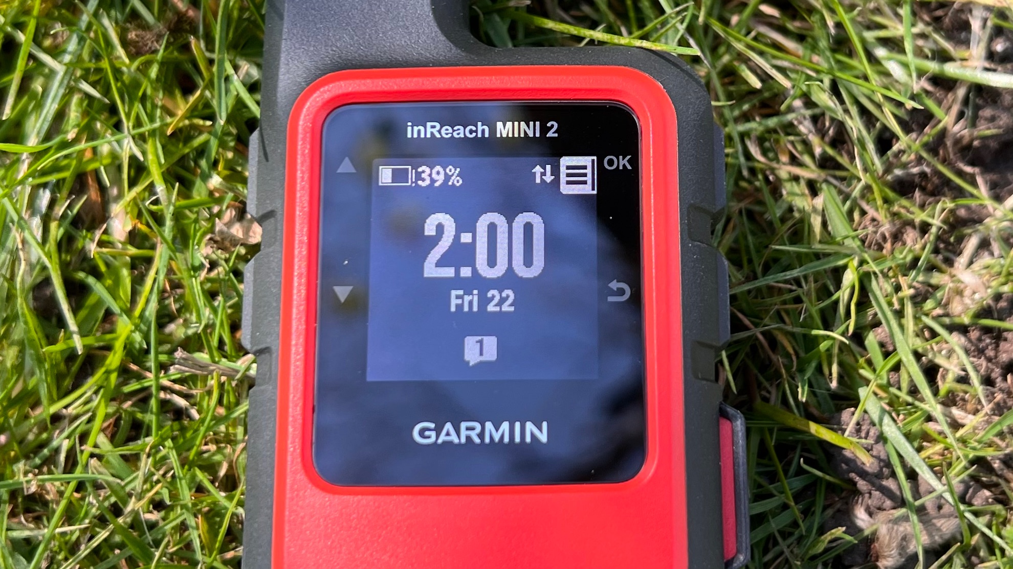
The monochrome display is extremely readable in bright sunlight thanks to its highly reflective backing. There's a backlight for night-time treks
The display here is a 23x23mm mono transflective memory-in-pixel display, a very low power display that's very bright in sunlight thanks to its very reflective backing. It's not particularly high resolution – it only has 176 x 176 pixels – but it's better than the previous model and the interface is clear and uncluttered, with switchable full-screen widgets rather than trying to cram everything onto the screen at once. As you'd expect from a small, non-touchscreen device, texting is very fiddly: you can use the companion phone app for much faster text entry.
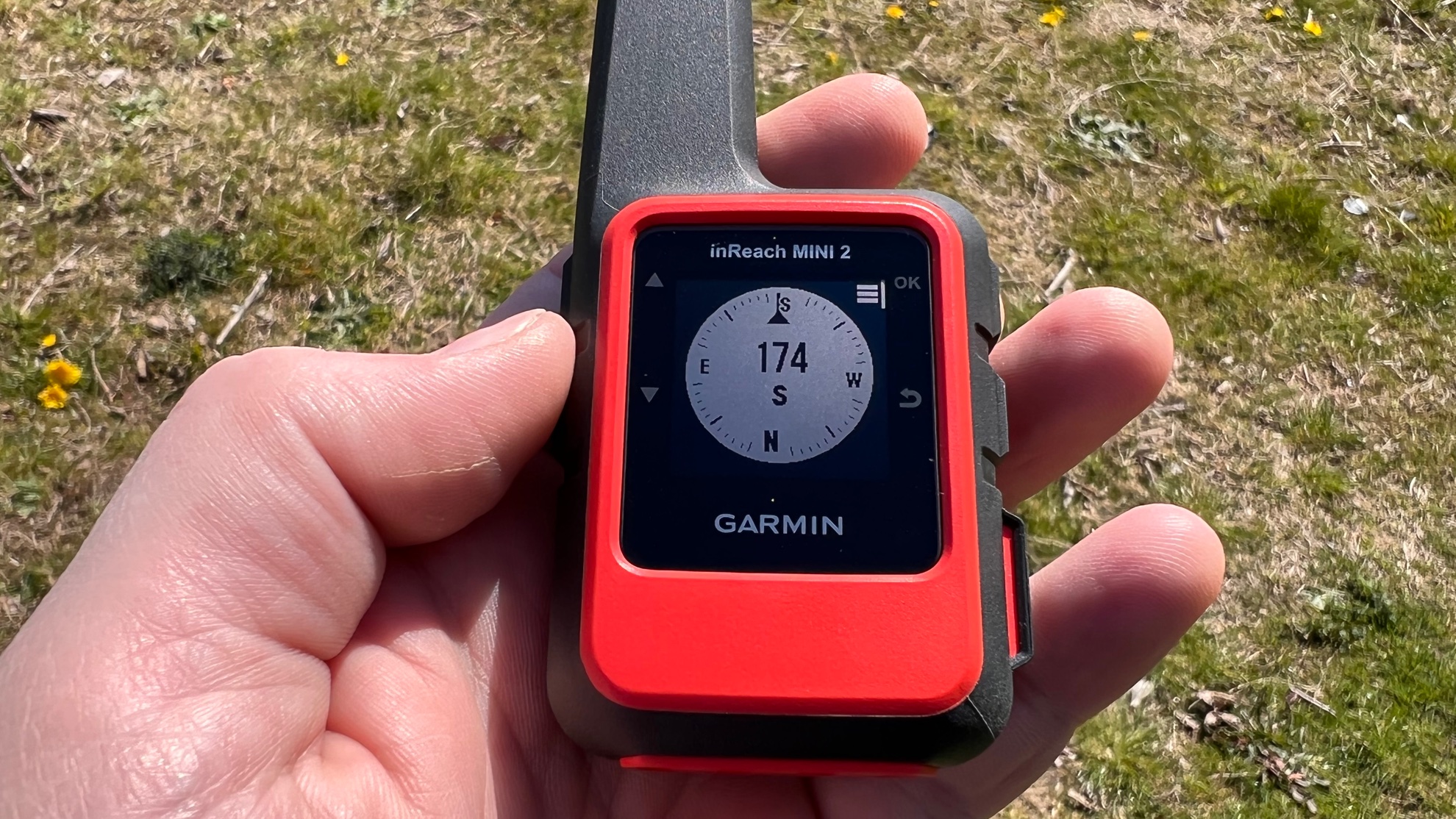
Rather than try to cram the screen with information, the Garmin uses widgets for features such as the compass (pictured here)
The battery here is a rechargeable lithium ion battery that charges by USB via the included USB-C cable. The USB port is protected by a strong, weatherproof cover, as is the SOS button, which means that feature can't be triggered accidentally. Battery life is up to 30 days in power-saving tracking mode, 90 hours with the default 10-minute tracking and up to one year when powered off; the more frequently you activate the display the quicker you'll burn through the battery.
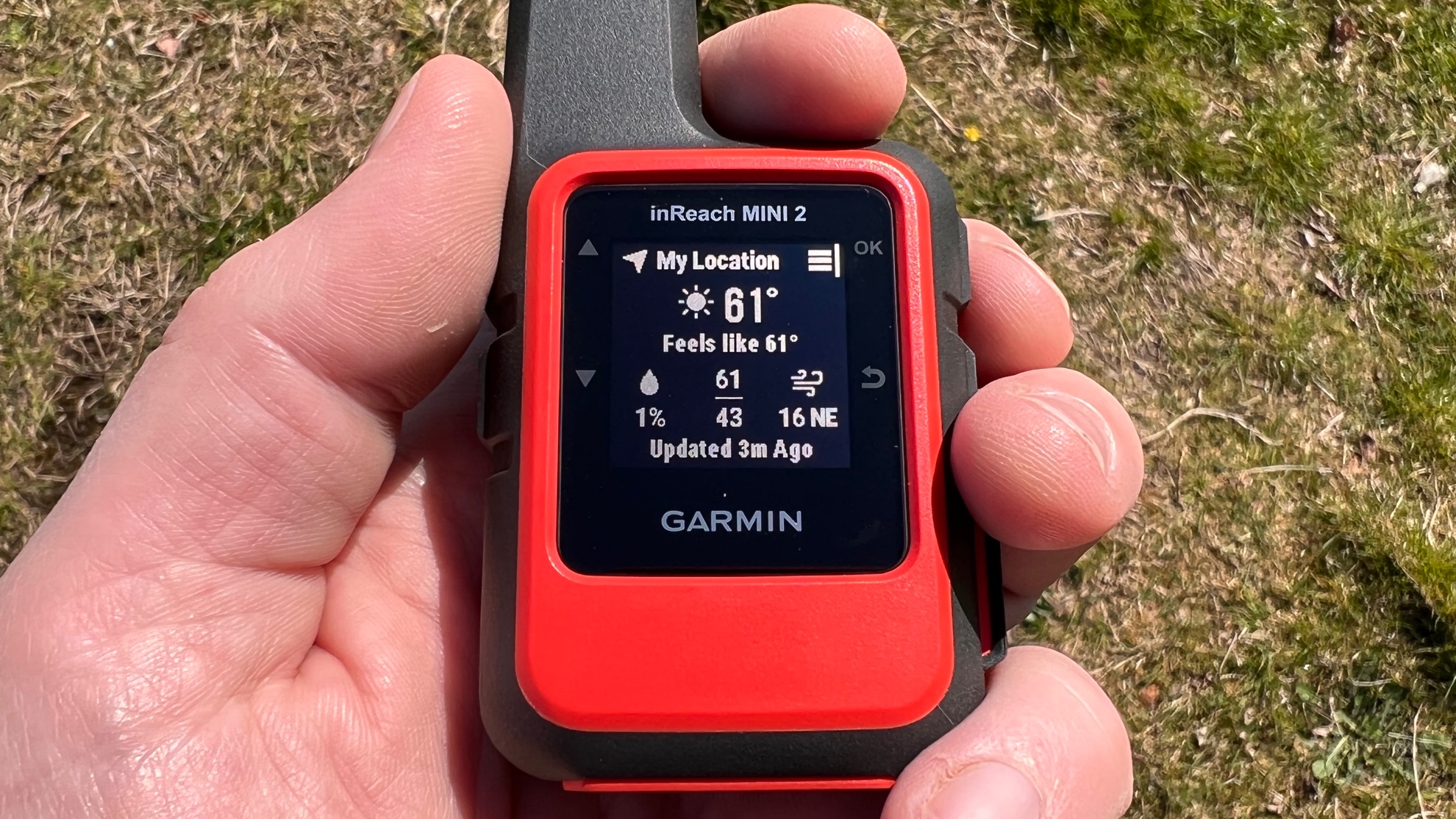
The screen isn't very high resolution but the user interface is clear and easy to read
There's an inevitable trade-off here between portability and battery: the Mini's small size makes it incredibly portable, but that means it can't have a battery of the same size as a full-sized inReach device and you'll need to ration your messaging and keep the backlight level low if you're on a long trek.
Garmin inReach Mini 2 review: subscription-based features
Taking out an inReach subscription adds the extra communications features. The most modestly priced plan enables you to make unlimited SOS calls and send ten custom messages (160 characters maximum, plain text, no media) per month. You can also send unlimited preset messages. These are simple messages – for example, At camp! Love you! – that you create online in advance for a defined group of family and/or friends and can then send from your device to update them on your status.
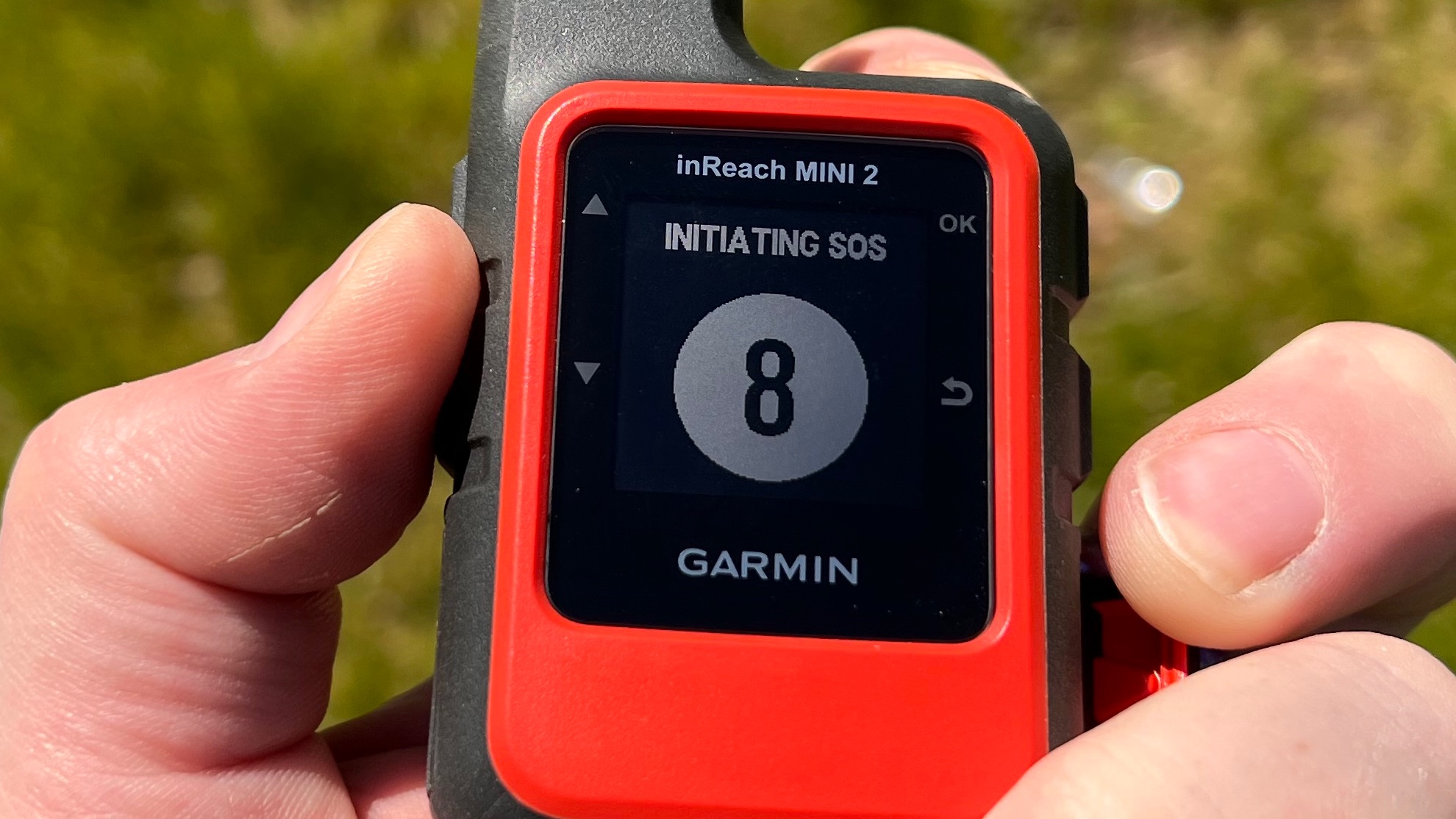
The SOS feature is protected by a cover and has a countdown when pressed so you don't trigger it accidentally
You can access basic weather data daily but other features, such as getting premium or premium marine weather are charged on a per-use basis. More expensive plans increase the amount of custom messages and also include more frequent tracking and unlimited track point sharing, but the advanced and marine weather still cost extra.
The most important feature in the inReach subscription plans is the SOS. If you get into trouble, you can open the protective cover and press the SOS button; that gives you 20 seconds to change your mind before calling Garmin's 24/7 emergency response centre. The centre can then communicate with you via your device and contact the appropriate search and rescue based on your location, giving you updates on their progress. When you first sign up you can also specify two emergency contacts that the emergency response centre can call on your behalf. The SOS feature is not limited on any of the plans, and it's rather like insurance: you hope you'll never need it, but if you do you'll be glad it's there.
Garmin inReach Mini 2 review: companion app
The Garmin Explore app is available for both iOS and Android. It is well designed and easy to use, enabling you to zoom in on topography to see how the land looks, to add waypoints or create courses (Garmin's name for routes) and to import map data in GPX format. The app can also use your device's location to show a fuller weather forecast than you can display on the Garmin device, to turn location tracking on or off or change the update frequency, and it can trigger the SOS feature. It also enables you to colour code and organise waypoints and other important locations into collections for easier access, and to play back your tracked travels at speeds from 1x to 128x.
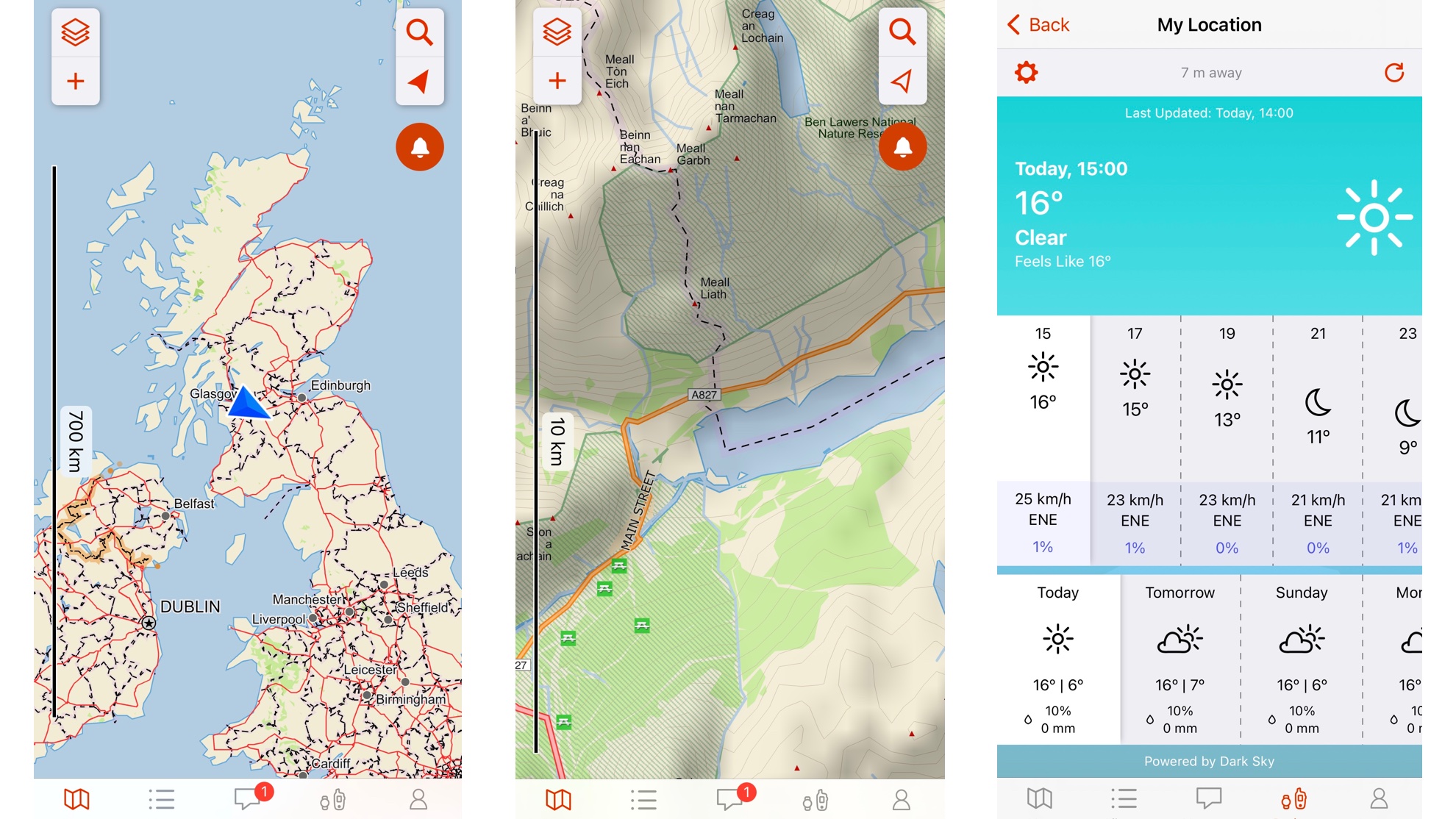
The Garmin Explore app is well designed and easy to use. It pairs with your device and you can use it to adjust settings and even trigger the SOS
Garmin inReach Mini 2 review: alternatives to consider
Garmin's other devices are well worth a look too. The Garmin GPSMAP 65s is an excellent outdoor GPS and our current pick for best hiking GPS, which also includes the very capable eTrex 30X. If budget is key here, Garmin's eTrex 10 is great value. And of course, if you want something more do-it-all, there are plenty of options in our best outdoor watch guide that have GPS capabilities.
Garmin inReach Mini 2 hiking GPS review: verdict
The original Mini was a very impressive device, and the Garmin inReach Mini 2 is better still: it has an improved display, better performance, improved navigation features and an excellent app. Provided you don't expect a phone-style experience from your messaging – satellite communications are simpler and slower and best kept to occasional updates – it's an excellent way to stay in touch when you're far from the madding crowd.
Sign up to the T3 newsletter for smarter living straight to your inbox
Get all the latest news, reviews, deals and buying guides on gorgeous tech, home and active products from the T3 experts
Writer, musician and broadcaster Carrie Marshall has been covering technology since 1998 and is particularly interested in how tech can help us live our best lives. Her CV is a who’s who of magazines, newspapers, websites and radio programmes ranging from T3, Techradar and MacFormat to the BBC, Sunday Post and People’s Friend. Carrie has written more than a dozen books, ghost-wrote two more and co-wrote seven more books and a Radio 2 documentary series; her memoir, Carrie Kills A Man, was shortlisted for the British Book Awards. When she’s not scribbling, Carrie is the singer in Glaswegian rock band Unquiet Mind (unquietmindmusic).
-
 Apple Watch personalisation could soon change dramatically – this is why
I can't wait for this feature
By Sam Cross Published
-
 Cambridge Audio's pretty pigmy amp packs a powerful punch
Cambridge Audio's new compact power amp is said to sound bigger than it looks
By Carrie Marshall Published
-
 You only need a kettlebell and these four exercises to build a stronger, resilient body
Push, pull, hinge and squat to build full-body, functional strength
By Bryony Firth-Bernard Published
